Studying glaciers . . . from Florida
Mickey MacKie, assistant professor of geological sciences and a glaciologist. Photo provided.
Welcome to From Florida, a podcast where you’ll learn how minds are connecting, great ideas are colliding and groundbreaking innovations become a reality because of the University of Florida.
Mickey MacKie, an assistant professor of geological sciences and a glaciologist, joined UF this summer. She has set up the Gator Glaciology Lab, where she and a team of undergraduate students are using machine learning tools to study conditions under glaciers to better understand movement and melting, which has implications for sea level rise. Produced by Nicci Brown, Brooke Adams, and James L. Sullivan. Original music by Daniel Townsend, a doctoral candidate in music composition in the College of the Arts.
Nicci Brown: Welcome to From Florida, where we share stories about the people, research and innovations taking place at the University of Florida. I'm your host, Nicci Brown.
Our guest today is Mickey MacKie, assistant professor of geological sciences and a glaciologist. Yes, you heard me right! She is studying glaciers from Florida. Mickey is one of UF's newest AI faculty members. She joined the university in August and we are delighted that she has brought her fascinating work to our campus. Welcome, Mickey.
Mickey MacKie: Thank you for having me.
Nicci Brown: We are so very glad that you decided to join us at the University of Florida. Can you tell us a bit more about your background, where you were previously and how you became interested in studying glaciers?
Mickey MacKie: Sure. I recently completed my Ph.D. in geophysics at Stanford, where I was interested in this problem of merging geological knowledge with machine learning tools so that we can better study the conditions underneath glaciers and ice sheets. So as an undergrad, I had a more classical geological training where I was a rock hammer-wielding geologist, going out into the field and looking at rocks from prehistoric ice ages.
And so, I've always been interested in glacial geology, but as I continued my education, I got more and more interested in modern ice sheets and geophysical methods like radar and then data science tools and machine learning. So, all of those things have sort of culminated into what I do now, which is developing and applying machine learning methods to study subsurface conditions in polar regions.
Nicci Brown: And at face value, Florida may seem like a very unlikely place to study ice sheets. What attracted you to UF?
Mickey MacKie: Yeah, I get that question a lot and what I always say is that the state of Florida has the most to lose when sea level rises. And so I think we have a lot of skin in the game and it's really important to be studying this question here in Florida. And what attracted me to the university in particular was this machine learning and AI initiative. So, I do machine learning research at ice sheet scales, which is non-trivial and requires a lot of computational resources.
And so I was very excited about the HiPerGator computing cluster and having the opportunity to use those resources that I could scale up my research. And I'm very excited to be at a place where there are so many different people working on machine learning problems and working on machine learning problems in different applications.
So, when I was in grad school and I took machine learning courses, I would take them in the computer science department and I would learn about facial recognition and things like that. And the types of tools that you use in facial recognition or CAT detection algorithms are completely different than what you need if you're studying the physical environment. So, I'm very happy to be in a place with lots of people who are working on different types of problems and are interested in developing these different tools.
And then, there are a number of members of my department in geology who are studying glacial geology through different lenses. And so there's all of this complementary geological and machine learning knowledge at UF that I'm very excited to bring together.
Mickey MacKie, assistant professor of geological sciences and a glaciologist. Photo provided.
Nicci Brown: Taking a step back, can you tell us a little bit more about what machine learning actually is?
Mickey MacKie: Yeah, it's a really broad field, but machine learning is any time where you're learning patterns from data in order to make predictions. And so, there are hundreds of different tools that fall into that bucket and I specialize in using tools and developing tools in such a way that we’re integrating geologic knowledge and making really geologically informed algorithm design choices to make these estimates.
Nicci Brown: And you have a lab, the gator, let me get this right . . . the Gator Glaciology Lab. Say that three times fast!
Mickey MacKie: I'm very proud of that!
Nicci Brown: Yeah. And you've got several undergraduate students working with you. Can you tell us a little bit more about the lab and about your student researchers?
Mickey MacKie: Yeah. So, I've just started building up the Gator Glaciology Lab. Right now, we have three undergraduate students in geology, computer science and mechanical engineering who are doing all sorts of cool research related to subglacial conditions. So, there's Caroline Riggall, who's analyzing radar data and using machine learning methods to characterize the geologic and hydrologic conditions underneath ice using radar data. I have another student, Matthew Hibbs, who is working on developing software that we're going to use to map the topography beneath the Greenland ice sheet. And finally, I have a geology student, Sam Williams, who's analyzing sediment core data offshore of Antarctica that we will be using to improve our reconstructions of past ice sheet behavior to give us insight into the future ice sheet evolution.
Nicci Brown: And is that the focus of your research, to really take a look at what that evolution will be?
Mickey MacKie: Yeah. We're really interested in what is underneath the ice. Glaciers are flowing bodies of ice that are sliding over the topography. If you imagine yourself going the slide, the shape of the slide, whether or not there's water and the roughness of the slide, those things are going to affect how fast you move. And the same is true for ice sheets and glaciers. So, we really need to know what the topography looks like under the ice, what the geology is and where there is liquid water if we want to be able to make good sea level rise projections.
Now, it's very difficult to do that because this environment is under a couple miles of ice and Antarctica is the size of the U.S. and Mexico put together and it's very difficult to access. You know, this environment has very limited data available. And what we do is we come up with ways to estimate those conditions at ice sheet-scales, so that we can use them as ice sheet model input parameters to make better sea level rise projections.
Nicci Brown: Do you do any field work as well as the work that you're doing in the lab?
Mickey MacKie: In theory, yes!
Nicci Brown: Yes.
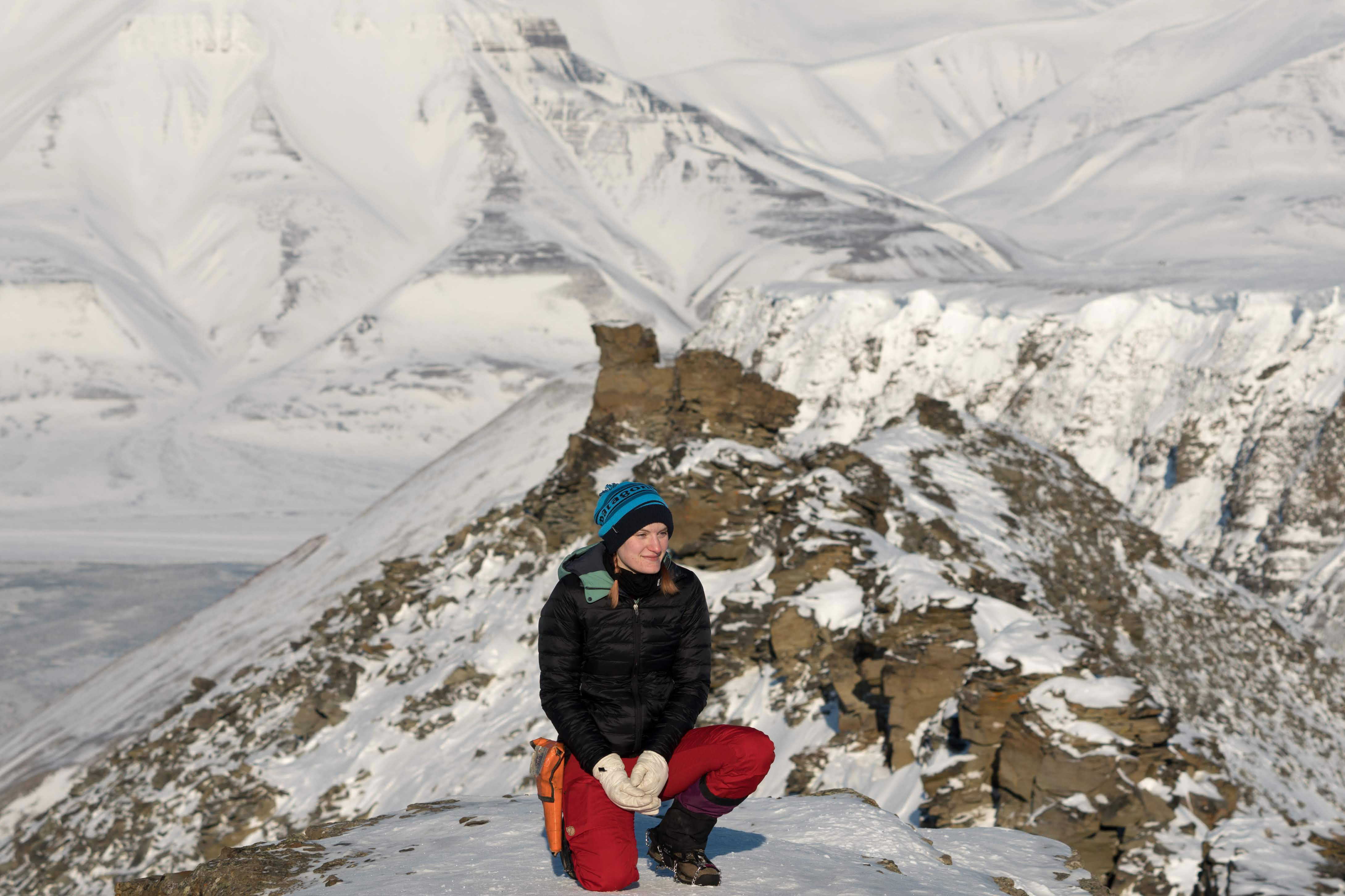
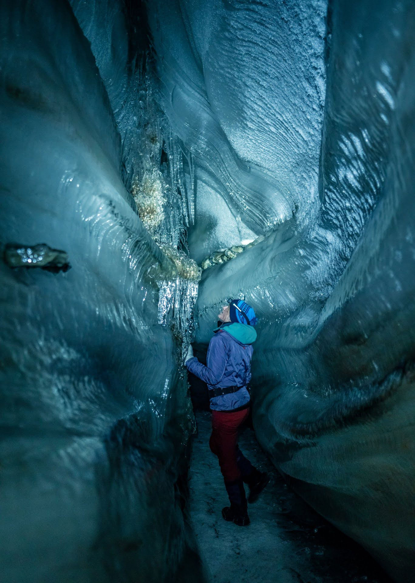
Mickey MacKie: Yeah, pandemic permitting, I'm hoping to go to Svalbard in a couple months. Svalbard is an island archipelago next to northeastern Greenland and it's got the highest density of polar bears in the world.
Nicci Brown: Are you ready for that?
Mickey MacKie: Yes, I am. I'm actually planning on brushing up on my rifle target practice because we do have to carry firearms for polar bear safety. But what we'll be doing out there is taking both seismic and radar measurements of glaciers there. And we're interested in both monitoring those glaciers because these smaller glaciers are a good canary in the coal mine for looking at climate change. But I'm also interested in developing ways that we can combine geophysical observations like radar and seismic data to make better large-scale estimates of the subglacial conditions. And so this is kind of a practice run for building up those methods so that eventually we can do this in Antarctica or Greenland.
Nicci Brown: And you mentioned the polar bears and it is a very real danger. I mean, we laugh, but it is something that has happened in the past to a lot of researchers. But what other challenges do you envision encountering doing this type of work?
Mickey MacKie: Yeah, polar regions have a lot of challenges. They're very remote. They're very cold. Last time I was in Svalbard, it hit minus 40, which is the same in Celsius and Fahrenheit. And so I remember my first season out there, I didn't even, I brought an insulated water bottle, but the cap wasn't insulated and my water froze. And they're just things like that I had to learn how to deal with. But yeah, we have an incredible logistics team out in Svalbard and I work with very experienced researchers, so I'm very excited to get back in the field.
Nicci Brown: And I'm guessing that those researchers come from all over the world.
Mickey MacKie: Yeah. In Svalbard we're collaborating mostly with Norwegian researchers at universities of Bergen and Tromsø, who are obviously very experienced at working in that environment.
Nicci Brown: Can you give us a sense of some of the questions that you're trying to answer?
Mickey MacKie: Yeah. So one of the things that is unique about the research that my lab does is the way we map the topography beneath ice sheets. So, we have measurements of the topography in some locations from airborne ice penetrating radar. So, radar mounted on airplanes is used to see through the ice and measure what the topography is. But we have a lot of gaps in measurements, sometimes up to hundreds of kilometers. And what most people do is they fill in those gaps with a flat surface. And that is not a very realistic basis to use for an ice sheet model. So, what we do instead is we come up with ways to simulate realistic looking topography in those blank spots. And, so the radar measurements nearby show that there are mountains then in between, it should look like there are mountains.
And instead of creating one map, we generate hundreds of realizations of the topography. So, you get an ensemble of maps that represent all the possible perturbations you could have based on existing measurements. And then you could imagine applying an ice sheet model to each of those instead of just one.
And that's really important because it allows us to represent sea level rise as a probability distribution instead of a single solution. And so you can imagine if you're building a nuclear power plant on the coast, you don't want to know what the 50th percentile sea-level rise scenario is going to look like. You want to know what's the worst possible trajectory so that you can build according to that scenario. And so our work is part of a bigger effort in the glaciology community to start working on quantifying our uncertainty in future sea-level rise projections so that we can give policy makers this information.
Nicci Brown: And I've got to imagine that having access to AI and a supercomputer is critical to being able to do that work.
Mickey MacKie: Yeah. Especially because we're talking about doing ice sheet scale simulations, multiple times, generating hundreds of realizations of the maps and then ultimately coupling that with an ice sheet model, which is also very computationally demanding work. So, I think these high-performance computing resources are going to play a big role in achieving that.
Nicci Brown: You mentioned that in the past we've thought about these ice sheets as being flat and we're discovering that that's no longer the case and we've got to treat them as such. What kind of impact does that have on our predictions?
Mickey MacKie: Yeah, so right now it's really difficult to say because we have not yet been able to run ice sheet models in this way using realistically rough topography. So, I think it's anyone's guess how these ice sheet models are going to respond.
We have done some preliminary work with ice sheet modelers at Cambridge on using simulated topography in very small areas and seeing how glaciers at very small scales behave with these different types of topographic maps. And, our initial results are showing that the ice deformation behavior is very different and the patterns of friction at the bed are very different and the spatial distributions of water is different. So, I think we're going to see some significant changes in the ice sheet response using the simulated topography, but we're going to have to work very closely with the ice sheet modeling community to be able to adapt ice sheet models to handle this type of information.
Nicci Brown: And this is the first time that it has been done at this scale?
Mickey MacKie: Yeah. Or this is the first time that we have used realistically rough topography in an ice sheet model at this very tiny scale.
Nicci Brown: And you mentioned the community. How many people are we talking about here?
Mickey MacKie: Yeah, so the glaciology community is pretty small, maybe a 1,000 or 1,500 people. And then the ice sheet modeling community, there may be a few dozen people who are really focused on ice sheet modeling development and applications. We're talking with people at Cambridge and at the NASA Jet Propulsion Laboratory and at Georgia Tech about how we can integrate our information with their ice sheet models.
Nicci Brown: Can you give us a sense of how big these ice sheets actually are?
Mickey MacKie: Yeah. The Antarctic ice sheet is the size of the U.S. and Mexico combined. And the Greenland ice sheet's a little smaller, but these are massive bodies of ice. Right now, the west Antarctic sheet, if that melted, that would lead to seven meters of sea level rise. So these are incredibly large volumes of ice that we're working with.
Nicci Brown: And speaking of that, there is a new international scientific research initiative that has just begun on the melting of the Thwaites Glacier. And that is actually known as the Doomsday Glacier, no threat there! Can you tell us a little more about that glacier and why scientists are so focused upon it?
Mickey MacKie: Yeah, so Thwaites Glacier, also known as the Doomsday Glacier, is a glacier about the size of Florida in west Antarctica that right now is losing the most ice out of any glacier in Antarctica. And we're really concerned about this glacier because if this glacier were to undergo significant ice loss, it would destabilize the west Antarctic ice sheet leading to seven meters of sea-level rise. And so a large fraction of my field is involved in efforts to study this glacier and better estimate the subglacial conditions at this glacier, so that we can improve sea-level rise projections for Thwaites and know how vulnerable the west Antarctic ice sheet is.
Right now, a lot of my lab's research is involved in this effort. So, Caroline and Sam, two of my undergrads, are working on projects related to Thwaites. I'm working on a project to estimate the topography and the geology at this glacier, because those are two major sources of uncertainty in ice sheet projections at Thwaites.
Thwaites is a primary concern for our field and for the foreseeable future I think we're going to be heavily focused on mapping and modeling this glacier.
Nicci Brown: Thwaites is known as the Doomsday Glacier. What does that actually mean? How concerned should we be?
Mickey MacKie: Yeah, so right now, we're very concerned about the ice shelf at Thwaites, which acts as a buffer for the glacier. So, glaciers have grounded ice, which is in contact with the topography, and then floating ice, the ice shelf. And the ice shelf helps stabilize the glacier. And right now, there are some signs showing that the ice shelf could start to break up in the next few years and that could significantly weaken the position of Thwaites Glacier. Now, I don't want to freak people out. I think it'll take approximately a few hundred years before Thwaites could undergo that significant retreat leading to the collapse of the west Antarctica ice sheet scenario, but we will be seeing the effects of ice sheet melts at Thwaites and, you know, throughout Antarctica and Greenland in decades to come. So, right now we're on track to hit about a meter of sea level rise by the end of the century.
Nicci Brown: And this is the window for us to do something to try and hold that at bay.
Mickey MacKie: Yeah. Yeah. And I think in our community, we talk a lot about tipping points or points of no return where if we don't do something before we hit one of those tipping points, then we're going to get caught in these runaway ice sheet melt cycles. And, so we're, we're interested in seeing if, you know, have we hit those tipping points yet? Or, when will we hit those and when can we still do something about it and if not, what is sea level rise going to look like and how can we prepare for it?
Nicci Brown: And you're talking about two extremes of the earth. The far north and the far south. Discoveries that are made in those areas, are they extendable to one another so what you find there, you can make a prediction to the south and likewise?
Mickey MacKie: That's a really interesting question. So there's a lot that's similar about these two ice sheets and the governing physics is the same, but from a machine learning standpoint, you actually have to be very careful about training on one glacier and applying it somewhere else because the statistical relationships could be entirely different in these two settings. And so a lot of the work we do can be applied to both of these glaciers, but we do have to be very mindful about how we transfer knowledge between the two.
Nicci Brown: I'm curious, how did you become interested in this field of work? Was it something that you started studying in one area and moved into? How did that come about?
Mickey MacKie: I got interested in this machine learning, geologic data integration field in my first year of grad school. I took a data science course for geologists and it was taught by Jeff Caers, a professor at Stanford who specializes in oil and mineral exploration and uses these types of data science methods to study subsurface conditions to look for oil. And I realized that you could easily adapt a lot of these methods, or schools of thought, to glaciers and come up with much more robust estimates of subsurface conditions at ice sheets as well. So, I actually work with a lot of petroleum engineers and people with mineral exploration backgrounds to study climate change.
Nicci Brown: And is it an area where you are seeing more interest? You mentioned your undergraduate research assistants. Is it a growing field?
Mickey MacKie: Yeah, I think especially here at UF, I'm noticing that the undergrad students are really interested in environmental science problems and are keenly aware of how important it is to study sea level rise in climate change.
Nicci Brown: Mickey, thank you so much for joining us today and thank you for your research.
Mickey MacKie: Thank you for having me. It's been great.
Nicci Brown: Listeners, thank you for joining us for another episode of 'From Florida'. I'm your host, Nicci Brown. And I hope you'll tune in next week.